Setting off from the windswept dunes of Wharariki Beach, we will make our way down through the rugged Kaituna route before entering the lush jungles of Kahurangi National Park. Departing from the famous Heaphy track, we will plot a course through the Tubman Range before attempting a first descent of the serene Heaphy River. Upon hitting the Tasman Sea we will scoot our way south to the beech forests of the Wangapeka track before traversing the Matiri Range into the Matiri valley, where we will attempt a first descent of the upper Matiri River. Upon reaching the mighty Buller River, we will scoot up the Mangles watershed to Nelson Lakes, the start of the towering Southern Alps.
Entering the Braeburn Range on the Tiramaumea track we will follow the trout filled waters of the Sabine River to rendezvous for the first time with Te Araroa (TAT), New Zealand’s national trail. Crossing the Alps at Waiau Pass, we will inflate our boats and celebrate our transition into Canterbury in style with a wild 45km float down the Waiau River. Linking back up with the TAT on the Hope River, we will have our first hot bath in the Hurunui hot springs.
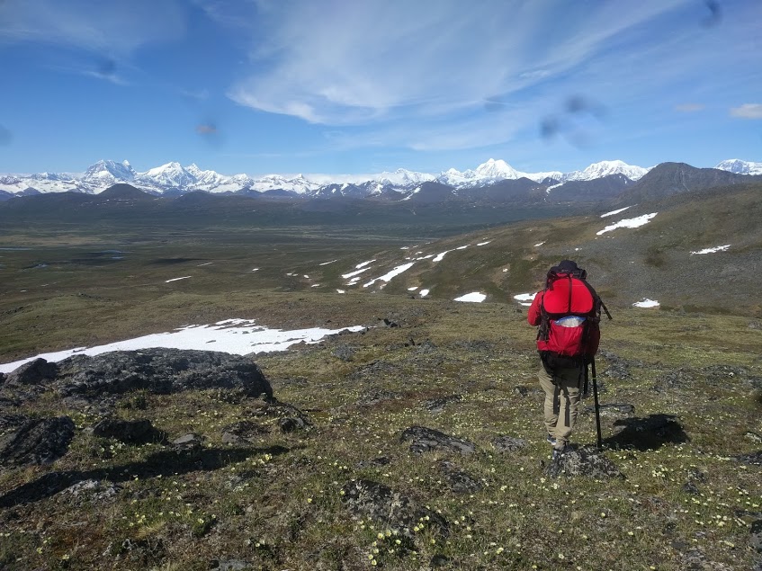
Refreshed and ready to go, we will again cross the Alps at Harper Pass before paddling the Taramakau River. We’ll restock at the jovially named town of Inchbonnie, and then paddle on to the start of the Taipo River trail. Harman Pass will be a challenging third pass over the Alps, leading us into the upper reaches of the Wilberforce River. With some luck, in the form of rain, we will attempt a first descent of the upper Wilberforce River, and then lazily float past Lake Coleridge to link up again with the TAT at the Glenrock stream trail. The remaining Canterbury sections will be an energetic mix of walking and scooting around, or, if the packraft begs to be let out to play, through, vast mountainous lakes.
A daring traverse of Broderick Pass will lead us back to the West Coast where world class rafting awaits us on the Landsborough River. After this raging torrent flows out of the mountains it slows and converges, finally delivering us back to the Tasman Sea by Haast. From here, we hug the rugged coast, scooting southwards with sweeping coastal views until we cross into Southland and join the magnificent Hollyford Track. Now in the Sounds, and in the mood for great walks, we will walk the Milford track and attempt a first descent of the stunning Clinton River (subject to permit; see attached kmz file, layer entitled ‘planned route’).
A knee-thrashing tramp over Dore Pass will take us into the Erlington River, which will push us south into Lake Te Anau. In the great southern lakes we have a hefty paddle to the Dusky track, eased via the rapids of the Waiau River. After 70km of battling passes and sandflies we will find ourselves in New Zealand’s deepest lake, famously named after the ferocious winds it routinely summons. At the mouth of Lake Hauroko, we hit the stunning Wairaurahiri River which floats us south to the Tasman Sea! Our packrafts packed up, no doubt equal parts sad to end and excited to eat, we have a final 2 days to unwind as we walk, buffeted by the winds of the South Coast track, towards Papatora Coast Road and the end of our 2 month adventure.
In addition to our planned route, we have mapped out a range of alternatives to take into account weather, water levels, DOC permissions, and adverse events such as earthquakes/landslides/track closures; these are in the kmz file in the layer entitled ‘alternative routes’.
NOTE: As we have been traversing south, we have taken alternate routes due to snowy passes, jagged passes, wild rivers and preference. The best way to see our current progress is on the pins section. We will also be producing an annotated ‘taken routes’ kmz at the conclusion of the traverse.
Detailed kmz files of our planned route are below. The download contains detailed information about trails, offtrack sections, river hazards and grades, lengths, distances and other information of note.
